Trucking And Logistics Need a New Way To Specify Location – Part 3
This article is the third in a series in which I review the costs and consequences of using street addresses in trucking and transportation and look at several alternative systems for referring to a location.
The first article, “Using Street Addresses Cost Trucking and Logistics Millions per Year” highlighted some of the high level issues the industry experiences when specifying the location for a drop-off or pick-up.
The second article, “Street Addresses in Trucking and Logistics” covered the pros and cons of the ubiquitous street address.
This article considers the use of latitude and longitude as a means of specifying location.
Ultimately, the goal of this series is to identify a location system which meets the following requirements:
- Uniquely identify a location
- Easy to repeat over the phone
- Easy to understand and type
- Easy to add to existing systems
- Can move with a location (because construction, growth, etc)
Latitude and longitude are a type of geographic “coordinates”. Like virtually all coordinate systems, latitude and longitude use a pair of numbers to specify a position on a surface. One number typically specifies the horizontal position (x axis) and the other specifies the vertical position (y axis).
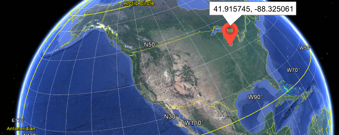
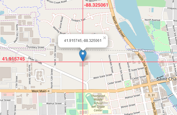
In the example below, a marker rests at 41.915745 degrees latitude and -88.325061 degrees longitude.
Although the concept of a geographic coordinate system dates back to the 3rd century B.C., it remains very widely used today. Boats in mid-ocean and planes in mid-air rely on coordinate systems like latitude and longitude to know their position and find their way. (It is interesting to note that these uses occur in machines and locations where there are no street addresses.)
Most navigation systems used by trucking and transportation use latitude and longitude as well. Although they appear to work using street addresses, they actually convert addresses to latitude and longitude and use those coordinates to identify location and provide routing. The process of converting a street address to its corresponding latitude and longitude is called “geocoding”.
The benefits of geographic coordinates like latitude and longitude include:
- Familiar
Most people have at least heard of latitude and longitude - Regular
While latitude and longitude can be specified using different units (degrees, minutes, and seconds, or decimal) they are both standard formats and mistakes can quickly and readily be identified - Specific
They can refer to a very small point on earth - Global
While street addresses vary widely between countries, latitude and longitude is a single system for anywhere on earth - Common
Latitude and longitude are used in almost all mapping software
Let’s see how addresses meet our requirements:
- Uniquely identify a location
No, while coordinates can refer to a very precise position on earth, there is no way to distinguish between different companies at that position. For example, 41.898767, -87.6253427 refers to the John Hancock building in downtown Chicago. WHile the coordinates are very precise as to position, they don’t communicate anything about which of the hundreds of business in that building - Easy to repeat over the phone
Mostly yes, but there can be confusion because of uncertainty over use of decimal or degrees and a reasonably precise set of coordinates can be 20-25 numbers - Easy to understand and type
Mostly, however you have to be clear if you’re using decimal or degrees and long sequences of numbers can be hard to verbalize - Easy to add to existing systems
Fair, latitude and longitude require only two fields, however, all street addresses would need to be geocoded - Can move with a location (because construction, growth, etc)
A big No. Geographic coordinates are absolutely tied to a single point on the surface of the earth. If a business moves, they would need to determine the coordinates of their new location and communicate that to their partners.
Overall grade: C-
The fact that we continue to use an idea that is over two thousand years old speaks to its utility and ingenuity; however, while latitude and longitude are essential to the mechanics of the systems we use today, they are not ideal for a means to specify location for trucking and transportation.
Next up in this series on location systems is a discussion and review of using What Three Words to specify location.
Until then, if you have feedback or thoughts, let me know.